One of the biggest challenges faced here on Earth – how to manage water resources for an ever-growing global population – may soon be solved more than 20,000 miles above our heads.
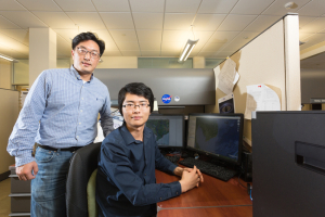
Principal investigator Hyongki Lee, associate professor of civil and environmental engineering, along with co-investigator and postdoctoral researcher Ning Cao received more than $320,000 in funding from NASA to help build a sustainable system for water management in the lower Mekong region of Southeast Asia, where several countries share a single water source.
The project is one of 32 funded by NASA in support of the Group on Earth Observations (GEO) Work Programme, an initiative that uses data obtained by Earth-observing technologies (such as satellites) to help inform decision-making on Earth, such as how to manage natural resources and maintain the health of our environment.
Lee and Cao were selected to help guide the future of effective global water management through the GEO Global Water Sustainability (GEOGLOWS) initiative.
As above, so below
The Mekong River in Southeast Asia stretches from China in the north to Cambodia in the south, crossing through Myanmar, Vietnam, Laos and Thailand along the way. The livelihoods of millions of people throughout the region depend on the Mekong’s waters for farming and fishing – the primary source of nutrition in the lower basin.
Although water is plentiful in the region, it is not evenly distributed among the countries according to needs, Lee says. In the lower Mekong especially, where several countries share a single water source, the need for sustainable water management tools is dire.
In 2016 Lee was selected by the NASA SERVIR program to lead a project managing water resources in Indochina by gathering data from satellite observations of the region and building a user-friendly software tool that allowed government officials to view information on water levels in real time.
“We take the raw data, then we analyze and process it to end up with a final product, which could be river level changes and groundwater storage changes, and even towards forecasting of them. We use the satellite data to solve scientific problems,” says Lee.
As it turns out, there’s a lot you can see from up above that isn’t so apparent down below.
“If a country upstream builds a dam, it can have catastrophic impacts on fishing and agricultural activities downstream,” Lee says. The availability of near real-time satellite data takes the guesswork out of water management policies, providing complementary hydrologic variables with unprecedented accuracy.
With this latest grant, Lee and Cao are taking the work a few steps further. Integrating several forms of satellite data and images, the UH engineers have created a software suite that allows users to view water levels across the Mekong region on a 3D map. The software toolbox can quantify and visualize changes in water storage over time, warning decision-makers when levels are dangerously high or low and even making valuable predictions on future changes.
Bridge over troubled waters
The low-lying deltas of the Mekong are especially vulnerable to water availability due to an increasing population, extensive irrigation and unchecked industrial development farther upstream. For many years locals relied on groundwater as the go-to water source, leading to land subsidence and increased risk of flood. Couple that with climate change and an inability to quantify changes in water storage levels across the region, and you’ve got some troubled (and unequally distributed) waters.
Thankfully Lee’s reputation for building bridges over troubled waters preceded him, and government in officials in Vietnam and Cambodia soon came calling for his assistance. A lack of groundwater resources in the lower Mekong means the ability to measure and predict surface water storage changes is critical. Lee and Cao’s software suite is the product available offering just that.
“This software suite can help stakeholders in those countries better understand and monitor surface water to improve water resource management across the entire transboundary basin,” Cao says.
With the suite of products, Lee and Cao will travel to Vietnam and Cambodia to train government officials in those countries on how to use the software in their decision-making on water policies.
Looking back, Lee says he wouldn’t be starting this latest NASA project without the help of a UH GEAR grant in 2016 that gave him the seed funding to build his software suite.
“I had great support getting to this point by working with Ning,” Lee says, adding that Cao’s exemplary work has impressed him for more than four years. Cao began working with Lee as a Ph.D. student and has developed innovative spaceborne and airborne interferometric synthetic aperture radar (InSAR) techniques which can provide 3D high-resolution water storage changes in the lower Mekong. “The fact that our proposal with Ning onboard as co-investigator has been selected highlights the importance and innovativeness of his past Ph.D. and current postdoctoral research,” Lee says.
Cao says he’s excited by the opportunity to continue working side-by-side with Lee for the duration of this three-year project.
“After that I’m not sure what’s next, but my experience with Dr. Lee has made me want to be a faculty,” Cao says.
