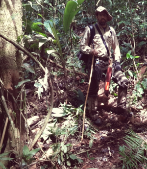
A scientist with the National Center for Airborne Laser Mapping (NCALM) at the University of Houston was part of the first expedition to a remote area of the Honduran rain forest, returning with more supporting evidence of an ancient civilization that has yet to be named.
Juan Carlos Fernandez Diaz said the group explored a small portion of the region the UH team mapped in 2012, when researchers completed the first light detection and ranging (LiDAR) survey of that country’s Mosquitia region.
In addition to Fernandez, the group included American and Honduran archaeologists, an anthropologist, a documentary film crew, Honduran military forces and a British security crew. A reporter and photographer from National Geographic also accompanied the crew, which traveled to Honduras last month to gather additional evidence of the civilization.
Originally, the 2012 LiDAR mapping triggered talk that researchers had found the legendary White City, or Ciudad Blanca. But Fernandez said they identified evidence of two main cities and several smaller settlements, indicating not the mythological city but instead extensive traces of an ancient civilization that scientists have been aware of for decades but still have not been able to fully identify or name.
UH serves as the operational center for the National Center for Airborne Laser Mapping (NCALM), a collaboration between UH and the University of California at Berkeley funded by the National Science Foundation. LiDAR is used in a variety of applications – archaeology, charting land erosion, mapping the sea floor and identifying levees in danger of failing, among others.
It works by shooting thousands of laser bursts per second at the ground – the newest technology sends 900,000 bursts per second – using the information gathered as the light returns to the source create detailed topographical maps.
Ramesh Shrestha, NCALM director and Hugh Roy and Lillie Cranz Cullen Distinguished Professor of civil and environmental engineering at UH, said the 2012 expedition returned with evidence of several distinct sites.
“Nobody knew what it was,” he said. “How do we know what is down there? They haven’t even named the civilization, but now they know it exists.”
Researchers documented the artifacts discovered last month but left them in place. Fernandez said the Honduran military has agreed to secure the area – the exact location hasn’t been named, to prevent looting.
It took more than two years for researchers to return after the initial discovery, in part, because there was no way to reach the area. Shrestha noted that there were no roads to the area, located in the midst of an impenetrable jungle.
While the 2012 mapping was done with airborne LiDAR, Fernandez took a smaller, portable LiDAR unit on this trip to document the artifacts and more finely detail the 2012 findings. But he said he and the other team members left with more questions than answers.
“We don’t know who they were, or how they lived, what foods they produced and consumed, or how they died,” he said of the original inhabitants.
When the area was inhabited is still a matter of debate. Preliminary estimates from external researchers suggest the area was inhabited sometime between 500 A.D. and 1500 A.D. Fernandez said that is just one subject among many for future researchers to pursue.
“This is one of the nice things about being on the cutting edge of science and technology,” he said. “More questions than answers.”
------
Read more about this story at CNN, ABC News, Time Magazine, The Guardian, The Huffington Post and The Houston Chronicle.
