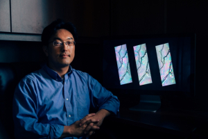
Hyongki Lee, assistant professor in the Cullen College’s department of civil and environmental engineering, has won NASA’s New (Early Career) Investigator Award in Earth Science. Out of over 130 proposals submitted to the New Investigator Program (NIP), only 21 were selected – two of which were from the University of Houston Cullen College of Engineering (click here to read more about ECE professor Saurabh Prasad's NASA NIP Award!). The New Investigator Program was established by NASA in 1996 to support outstanding scientific research and career development of scientists and engineers at the early stages of their professional careers.
Lee, who joined the University of Houston Cullen College of Engineering in 2011, certainly fits the bill. Although still considered a newcomer to the university, Lee has already taken on highly ambitious research projects providing a basis for new hydrologic research. Lee’s NIP award centers on research he’s conducting in order to better understand the hydrology and hydrodynamics of the waters in the Conger River Basin and its connection with climate change, deforestation, and the amount of carbon emitted from Congo waters. Lee will receive approximately $335,000 over three years to complete this research.
With a surface area of approximately 3.7 million square kilometers, the Congo River Basin is the second largest river basin in the world, surpassed only by the Amazon. Compared to the Amazon, though, the Congo basin is a mystery. Its remote location combined with political instability in the region have prevented researchers from gathering even the most basic information about the basin: How much water exists in its wetlands? Is most of this water from direct precipitation, river flooding or upland runoff? How does deforestation impact downstream discharge? Is the Congo Basin a carbon sink? All of these are unknowns.
But even though very few researchers have been able to enter the Congo basin on foot to collect data, there is still data on this region that’s being collected. Satellites orbiting around the Earth are constantly observing our planet from above, but these bird’s eye images of the Congo wetlands provide only the crudest details of a very vast and highly complex ecosystem.
Luckily, Lee is an expert at taking the various forms of satellite remote sensing data and combining them to answer complex earth science questions. In this particular project, Lee will integrate satellite radar images, satellite radar altimetry data, and multi-spectral satellite images to create two-dimensional, high-resolution maps of water balances of the Congo wetlands. The maps Lee generates of the region will help to answer the most pressing questions of how water flows in the region, what the main sources of water are, the patterns of wetland storage and its contribution to global methane emissions.
Lee, who also serves as a researcher with the National Center for Airborne Laser Mapping (NCALM), said he hopes to eventually collect topographic and bathymetric LiDAR (light detection and ranging) data in this region to augment the maps he creates. According to Lee, this project should give researchers a better understanding of everything from regional climate change to greenhouse gas emissions.
Combining multiple types of data from different satellites is basically unheard of in hydrologic research, Lee noted. If successful, this work will provide investigators with an entirely new method for studying areas of the planet that are otherwise inaccessible. “This is a new combination of technologies for this application,” said Lee. “It’s a first attempt. That’s one of the reasons we proposed it.”
Beyond the establishment of a new model for collecting hydrology data in remote or inaccessible parts of the world, Lee hopes this project will help to highlight the importance of continuing NASA’s many ongoing satellite programs, such as the Surface Water Ocean Topography (SWOT) mission, which places an emphasis on a better understanding of earth’s terrestrial surface waters by measuring water storage changes.
“Satellites and satellite observations hugely benefit our society,” Lee said. “I think it’s important to remind people how many of these are up in the sky right now, collecting abundant data that’s just waiting for us to utilize it.”