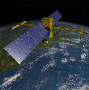
Hyongki Lee, assistant professor of civil and environmental engineering at the Cullen College, is making quite a splash. Lee has accomplished so much in the field of water you could say he’s all over the map, but soon his work will be high above the map. He’s helped Pakistani officials manage water resources and was selected by NASA to do the same in Indochina. Now NASA has come calling again, making Lee part of the pre-launch team for their Surface Water & Ocean Topography (SWOT) satellite mission – set to go airborne in 2020 – to conduct the first global survey of Earth's surface water.
No satellite mission has ever been designed to specifically examine surface water - SWOT is the first of its kind. In 2007, the National Research Council Decadal Survey of Earth Science selected it as one of the missions that NASA should implement in the next decade.
According to NASA the SWOT mission, which is a joint venture with CNES, the French space agency, “will provide the very first comprehensive view of Earth's freshwater bodies from space and will allow scientists to determine the height and area of fresh water across the globe at an unprecedented resolution.”
Maybe it’s time
The truth is no one really knows how much water we have on Earth or understands much about its movement. “We don’t have much clue,” said Lee.
Come 2020, after the SWOT satellite mission gathers its data of freshwater storage changes in global lakes, he hopes to have more than just a clue – especially about the Mississippi Basin, which is the portion of the mission he is examining.
“How much water we have in the world is a fundamental question and mystery of science,” said Lee. “We need to first have a holistic picture of where water is and how much there is. Those are the questions we need to answer to have proper resource management.”
To help find the answers, NASA will give Lee $80,000 over the next four years. The principle investigator (PI) is Edward Beighley of Northeastern University and two other co-PIs come from Ohio State University and the Jet Propulsion Laboratory.
But first, math and computer science
The very trajectory of the satellite, or orbital design, is something Lee has had a hand in developing. In 2010 he helped determine which way the SWOT satellite must travel to get that holistic look at the world’s terrestrial surface waters.
Now Lee has switched his own trajectory, concentrating on developing the scientific algorithm that will determine water discharge amounts. The satellite will gather the data and then go through the formula being developed by Lee and his colleagues.
“The algorithm will make the information readily accessible and usable,” said Lee.
To create the algorithm, Lee and his colleagues will use SWOT-like data, simulating and predicting the information SWOT will eventually deliver. To develop the SWOT-like data, the team will use existing satellite measurements including lake storage changes, river level elevation data, precipitation data and a hydrology model.
“Once we have all this we can think about what kind of algorithms to use to calculate the river discharge from the real SWOT data,” said Lee.
An international mix from above
When the math is delivered, NASA will use it to continue planning the mission. Then, in 2020, high above our heads, SWOT’s eyes in the sky will observe the details of our surface water and measure how all the bodies of water change with time.
Those details will be delivered to the mission alliance, comprised of U.S. and French oceanographers, hydrologists and other international partners who have been with the project since the concept was first developed in the early 2000s.
If measured in time, the project has taken a good bit, but in this water-thirsty world the need for basic information about this precious natural resource is incalculable.
“Using data from the SWOT satellite mission, our expectation is to have a more complete understanding of surface water distribution and volume changes,” said Lee.

