Hyongki Lee, an assistant professor of civil and environmental engineering with the University of Houston Cullen College of Engineering, is part of an international team studying shrinking mountain glaciers and ice caps using satellite remote sensing measurements.
Researchers at Ohio State University lead the project, which recently won a three-year, roughly $600,000 grant from NASA, with $144,579 of that dedicated to Lee’s portion of the project. Other collaborators come from Queen’s University and Trent University, both located in Ontario, Canada.
Understanding the ice loss of glaciers, said Lee, can provide researchers worldwide with a better understanding of the contributors to climate change-based sea level rises. This effort is also important because of the role glaciers plays in ecosystems and societies, he added. Himalayan Mountain glaciers, for example, are the source of the continent’s nineteen major rivers, which supply water to 3 billion people. Any changes they undergo can have enormous ramifications.
The research team will use three types of satellite data taken during the past 21 years to measure the mass of ice that has melted from these glaciers. These include satellite images, satellite-generated gravity maps of the region, and satellite radar altimeter, which measures height based on how radio waves scatter when they bounce off objects. Lee’s role in the grant is developing methods to process the altimeter data.
This is a challenge, he said, because satellite altimeter is typically used to measure sea levels. The on-board instrumentation is designed to read the electromagnetic scattering characteristics of the relatively smooth ocean surface. Mountain glaciers have widely varying heights, leading to different scattering characteristics. Lee, then, is developing a new model for interpreting altimeter data that is tailored specifically for glacier surfaces. This will provide much more accurate height information.
That’s not all Lee is reworking.
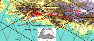
Typically, researchers take data from two different satellites, one moving roughly from north to south, and the other roughly south to north. The paths of these satellites essentially form a grid. At the grid’s intersections, known as crossover locations, researchers use data from both satellites to determine the height of the surface being scanned.
Lee, though, is developing a technique to measure height changes along the entire path of each satellite. Since a satellite’s orbit takes it over the same places again and again, he will stack those height measurements to estimate the height changes – essentially going from measuring the intersections of the grid to measuring entire lines. He will also work to minimize the error caused by the drift of the satellites’ orbits, which are impacted by solar radiation pressure and variations in the Earth’s gravitational field.
The result will be a much richer, more detailed height map of the Himalayan glaciers. “The satellite paths intersect approximately every 100 to 300 kilometers. With this new method, we’ll have measurements about every 350 meters,” he said.
The team can then combine these altimeter readings with the satellite images and gravity map data, enabling them to calculate the mass of the ice lost at different points over the past 20-plus years. They will then match up these different levels of ice loss with sea level changes during the same points in time, providing scientists with a greater understanding of the contributors to sea level rise.
“We measure things like thermal expansion and ice sheet melt and convert it to sea level volume. It should match the observed sea level rise. But in reality it doesn’t,” said Lee. “Part of the problem is we have a very poor knowledge of mountain glacier and ice cap mass balance. This research will help provide those pieces of the puzzle.”
